Hanoi is the Capital of the Socialist Republic of Vietnam, and it takes a vital role in leading a political, cultural, and technical center.
Hanoi is located in Northern Vietnam, with a long history, tasty cuisine, and many beautiful tourist attractions. This city has been a first-come geographical place to explore nearby destinations, such as Sapa, Halong Bay, and Ninh Binh.

Geographic coordinates
Hanoi’s relative location is situated at 21,0278 ° north latitude and 105,8342 ° east longitude.
This city has 9 neighboring provinces:
- Thai Nguyen and Vinh Phuc in the north,
- Hoa Binh and Phu Tho in the west.
- Ha Nam and Hoa Binh in the south, and
- Bac Giang, Bac Ninh, and Hung Yen in the east.
Natural conditions
The area of Hanoi is over 3,359 km² and is in the top 17 capitals with the largest regions in the world.
The two big rivers, including the Da River on the right and the Red River on both sides, cover Hanoi, creating the city inside the rivers. Ha means river, and Noi means inside.
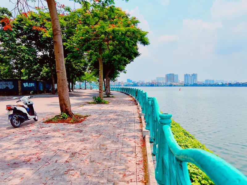
With this typical natural condition, it’s not difficult to find many lakes in Hanoi, which have become natural conditions to mild the weather here. Among them, Hoan Kiem Lake and West Lake are famous sites attracting many tourists to visit and take pictures of.
The climate of Hanoi has the typical type of Northern weather with the characteristics of a tropical monsoon, which is humid – hot – rainy in summer and cold – less rainy in winter.
The city receives high solar radiation year-round and has a high temperature because of situating in the tropics. Its annual sunshine volume is about 120kcal/cm2 on average, and the annual air temperature is 23.60C on average.
Besides, Hanoi gets high humidity and rainfall due to the influence of the sea temperature. The average humidity is from 80 – 82%, and the average annual rainfall is over 1,700mm/year, about 114 rainy days per year. However, you can find that a short autumn is the best time to visit Hanoi.
Districts in Hanoi
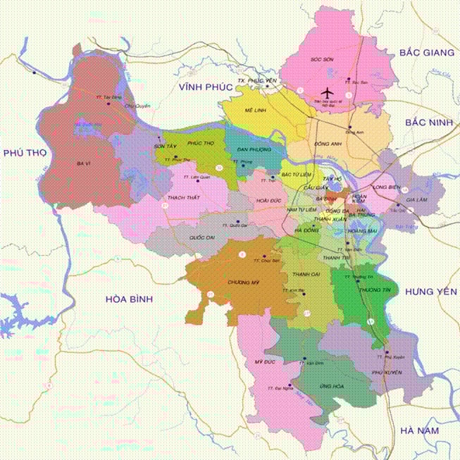
12 urban districts include Hoan Kiem, Dong Da, Ba Dinh, Hai Ba Trung, Tay Ho, Hoang Mai, Cau Giay, Thanh Xuan, Ha Dong, Long Bien, North Tu Liem, and South Tu Liem.
These central districts are Hoan Kiem, Ba Dinh, Dong Da, and Hai Ba Trung. Specifically, the Hoan Kiem district has a beautiful old quarter, which attracts plenty of tourists to spend time there.
1 town: Son Tay Town
17 outside central districts cover Ba Vi, Chuong My, Dan Phuong, Dong Anh, Gia Lam, Hoai Duc, Me Linh, My Duc, Phu Xuyen, Phuc Tho, Quoc Oai, Soc Son, Thach That, Thanh Oai, Thanh Tri, Thuong Tin, and Ung Hoa.
With this favorable location, Hanoi also owns Noi Bai International Airport, the second largest airport in the country, after Tan Son Nhat Airport in Ho Chi Minh City. Therefore, Hanoi has become a convenient destination for you to start your journey to explore Vietnam.